Track International Space Station Location with JavaScript

Hello Folks 👋
What's up friends, this is SnowBit here. I am a young passionate and self-taught developer and have an intention to become a successful developer.
Today, I am here with an amazing topic that will be fun sharing 🛰
What is ISS?
The International Space Station is a modular space station in low Earth orbit. It is a multinational collaborative project involving five participating space agencies: NASA, Roscosmos, JAXA, ESA, and CSA. The ownership and use of the space station is established by intergovernmental treaties and agreements.
Source Wikipedia
Let's get on to the code 😎
Step 1 - Map
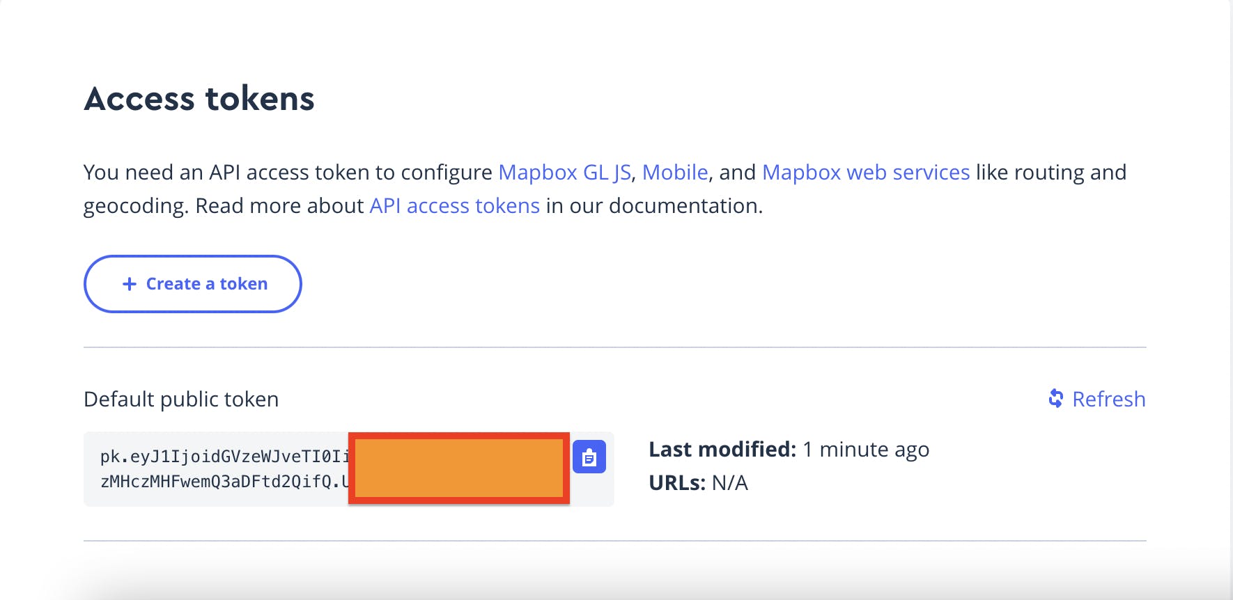
- Go to Mapbox and create account
- Copy and save your public token

Step 2 - Import Mapbox
<script src='https://api.mapbox.com/mapbox-gl-js/v2.6.1/mapbox-gl.js'></script>
<link href='https://api.mapbox.com/mapbox-gl-js/v2.6.1/mapbox-gl.css' rel='stylesheet' />
Paste this in the <head> tag of your .html file
Step 3 - Setting map
In your Javascript file.
mapboxgl.accessToken = 'YOUR_PUBLIC_TOKEN';
    const map = new mapboxgl.Map({
    container: 'map',
    style: 'mapbox://styles/mapbox/dark-v10',
    center: [-74.5, 40],
    zoom: 0
    });
Display map
const ISSLoc = (lng, lat) => {

    const geojson = {
        type: 'FeatureCollection',
        features: [
          {
            type: 'Feature',
            geometry: {
              type: 'Point',
              coordinates: [lng, lat]
            },
            properties: {
                title: 'Mapbox',
                description: 'San Francisco, California'
              }
          },
        ]
      };
      for (const feature of geojson.features) {
        const el = document.getElementById('marker');

        new mapboxgl.Marker(el).setLngLat(feature.geometry.coordinates).addTo(map);
      }
      new mapboxgl.Marker(el)
      .setLngLat(feature.geometry.coordinates)
      .setPopup(
        new mapboxgl.Popup({ offset: 25 }) // add popups
          .setHTML(
            `<h3>${feature.properties.title}</h3><p>${feature.properties.description}</p>`
          )
      )
      .addTo(map);
      new mapboxgl.Marker(el)
  .setLngLat(feature.geometry.coordinates)
  .setPopup(
    new mapboxgl.Popup({ offset: 25 }) // add popups
      .setHTML(
        `<h3>${feature.properties.title}</h3><p>${feature.properties.description}</p>`
      )
  )
  .addTo(map);
}
Step 4 - Styling popups
In your CSS file.
.marker {
    background-image: url('sat.png');
    background-size: cover;
    width: 50px;
    height: 50px;
    border-radius: 50%;
    cursor: pointer;
}
.mapboxgl-popup {
  max-width: 200px;
}

.mapboxgl-popup-content {
  text-align: center;
  font-family: 'Open Sans', sans-serif;
}
Image file: sat.png
Step 5 - Get ISS Position
const getISSLoc = () => {
    fetch('https://api.wheretheiss.at/v1/satellites/25544')
    .then(response => response.json())
    .then(data => {
        ISSLoc(data.longitude, data.latitude)
        long = data.longitude
        latt = data.latitude
    })
}
Update ISS Position every second
const updateISSLoc = () => {
    setInterval(() => {
        getISSLoc()
    }, 1000  )
}
updateISSLoc()
And you made it 👏
Check out the full source code: github.com/codewithsnowbit/ISS-Live-Location
Thank you for reading, have a nice day! Your appreciation is my motivation 😊
- Follow me on Twitter - @codewithsnowbit
- Subscribe to me on YouTube - Code With SnowBit

